Issue
The National Wetlands Inventory is the most comprehensive wetland geospatial dataset in the United States; however, since the inventory can be costly and time-consuming to maintain, large areas of wetlands are not updated regularly and therefore rely on data that is 10 to 20 years old. The release of NOAA’s high-resolution land cover data provides an opportunity for a cost-effective approach to keeping the dataset up-to-date that was previously impossible at the 30-meter resolution scale.
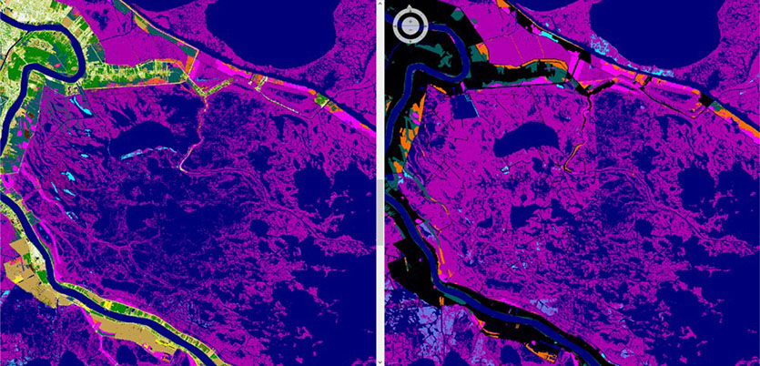
Process
Using New Orleans, Louisiana, as a pilot site, researchers from the University of Maryland used NOAA’s high-resolution land cover data and compared it to wetland maps within the inventory. The researchers developed automated techniques to identify changes in the wetlands, such as areas that were developed into impervious surfaces or areas that gained open water. They then added this information to the existing wetland inventory to make the inventory more accurate and useful. By focusing on areas with the most significant changes, researchers aim to be able to update the inventory more quickly in the future.
Impact
This method of updating the National Wetlands Inventory is faster and cheaper than previous methods. This means higher-quality information is in the hands of decision-makers when targeting watersheds with the most significant changes for maintenance, thereby reducing work areas. This approach also helps reduce duplicative efforts and ensures consistency between the datasets. (2024)