Issue
Studies suggest that relative sea-level rise is not only occurring on the Eastern Shore of Virginia, but also appears to be accelerating, with several areas already vulnerable to road closures during storm and flooding events. Future elevated water levels will likely have increasingly significant impacts on transportation infrastructure and the communities, facilities, and economies that depend on them.
Process
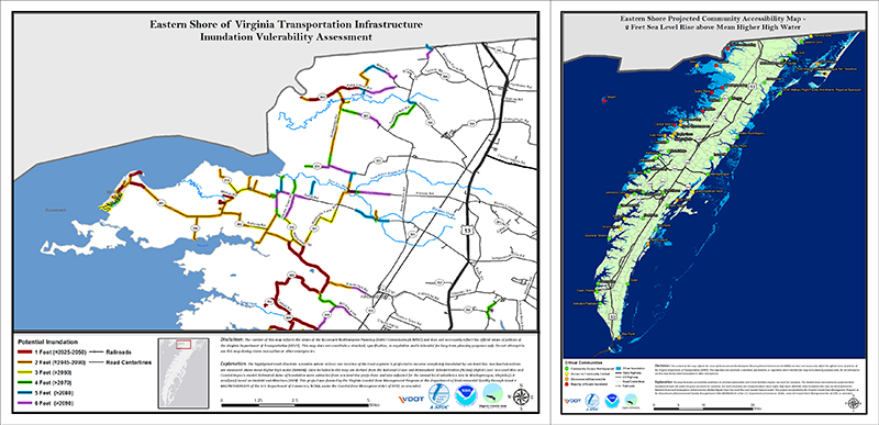
To address these long-range sea-level rise issues, a screening-level assessment was conducted to determine the possible effects on transportation infrastructure and communities, and when these changes were projected to occur. Output data sets from the NOAA Sea Level Rise Viewer were utilized to perform two separate assessments: a regional transportation infrastructure inundation vulnerability assessment, and a community and critical facility accessibility assessment. The lidar utilized in the model provided the surface elevations of roads, with adequate resolution for long-range planning purposes. The data were combined with road data from the Virginia Department of Transportation to determine which road segments were vulnerable under various inundation scenarios. Relative sea level rise projections by the Virginia Institute of Marine Science were used to project the timing of various inundation scenarios.
Impact
The studies provided critical information to planners and officials about how inundation could affect their communities. The inundation vulnerability assessment determined that 33 miles of roads in the region would be vulnerable to inundation within the next few decades with 1 foot of sea-level rise. With a 6-foot rise, almost a quarter of all roads could be vulnerable as early as 2090. The accessibility assessment evaluated over 50 communities and found various problems, with seven communities possibly inaccessible during high tide beginning sometime between 2025 and 2050 with 1-foot of sea-level rise. Additionally, the Chincoteague Causeway, which serves as the sole access route to the Town of Chincoteague, the Chincoteague National Wildlife Refuge, and the Assateague Island National Seashore, was found to be vulnerable to inundation beginning sometime between 2045 and 2090.

